


Voting District 0357300000002, Clare County, Michigan
About
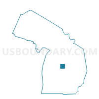
Outline

Summary
| Unique Area Identifier | 596248 |
| Name | Voting District 0357300000002 |
| County | Clare County |
| State | Michigan |
| Area (square miles) | 12.58 |
| Land Area (square miles) | 12.49 |
| Water Area (square miles) | 0.08 |
| % of Land Area | 99.33 |
| % of Water Area | 0.67 |
| Latitude of the Internal Point | 43.83619420 |
| Longtitude of the Internal Point | -84.66676340 |
Maps


Graphs
Select a template below for downloading or customizing gragh for Voting District 0357300000002, Clare County, Michigan


Neighbors
Neighoring Voting District (by Name) Neighboring Voting District on the Map
- Voting District 0353422000001, Clare County, MI
- Voting District 0357300000001, Clare County, MI
- Voting District 0510668000001, Gladwin County, MI
- Voting District 0738200000001, Isabella County, MI
- Voting District 0738804000001, Isabella County, MI
- Voting District 1118402000001, Midland County, MI
Top 10 Neighboring County Subdivision (by Population) Neighboring County Subdivision on the Map
- Grant township, Clare County, MI (3,259)
- Warren township, Midland County, MI (2,119)
- Beaverton township, Gladwin County, MI (1,964)
- Sheridan township, Clare County, MI (1,575)
- Wise township, Isabella County, MI (1,397)
- Vernon township, Isabella County, MI (1,369)
Top 10 Neighboring Unified School District (by Population) Neighboring Unified School District on the Map
- Beaverton Rural Schools, MI (10,151)
- Clare Public Schools, MI (8,546)
- Coleman Community School District, MI (5,929)
Top 10 Neighboring State Legislative District Lower Chamber (by Population) Neighboring State Legislative District Lower Chamber on the Map
Top 10 Neighboring State Legislative District Upper Chamber (by Population) Neighboring State Legislative District Upper Chamber on the Map
- State Senate District 33, MI (272,940)
- State Senate District 35, MI (261,943)
- State Senate District 36, MI (254,090)
Top 10 Neighboring 111th Congressional District (by Population) Neighboring 111th Congressional District on the Map
Top 10 Neighboring Census Tract (by Population) Neighboring Census Tract on the Map
- Census Tract 9402, Isabella County, MI (5,699)
- Census Tract 2917, Midland County, MI (4,418)
- Census Tract 8, Clare County, MI (4,283)
- Census Tract 8, Gladwin County, MI (3,973)
- Census Tract 1, Isabella County, MI (3,652)